Days: 1: Arrive at Tribhuwan International Airport Kathmandu
After arriving in Kathmandu, a representative from Nepal New Generation will pick us up from the airport and take us to our hotel. In the afternoon, we may take a rest or visit Nepal New Generation’s office. In the evening, there will be a welcome dinner hosted by Nepal New Generation. For dinner, you will be served authentic Nepalese cuisine which will introduce you to the country’s food culture. Overnight in Kathmandu. Included meals:Dinne
Days: 2: Obtain Bhutan Visa and Kathmandu Valley Sightseeing Tour
After breakfast, our guide will take you for guided tour of Kathmandu city. We will begin with Pashupatinath Temple which is famous Hindu Temple of Lord Shiva at the bank of holy Bagmati River. After this, we continue to Boudhanath Stupa, which is giant Stupa in Asia and a focal point of Tibetan Buddhism in Kathmandu. Later on we proceed to Swayambhunath Stupa also know as Monkey Temple in a small hill in Kathmandu which gives you great view of Kathmandu valley and mountains on north. Further, we drive 10 minutes to Kathmandu Durbar Square where Nepalese kings used to get throne. Interesting places to see here are Taleju Temple, Statue of Kal Bhairabh and Hanuman, Temple of Jagannath (Erotic Temple) and Kastamandap Temple from which Kathmandu got it name. We visit Kumari Temple and pay homage to the living goddess, Kumari and also walk around the Freak streets which was famous during Hippy era in 60's and 70's. Accommodation: Overnight at Hotel in Kathmandu. Meals: B
Days: 3 - Fly to Paro, 2,250m/7,380ft. Sightseeing as time permits.
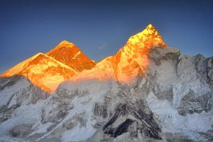
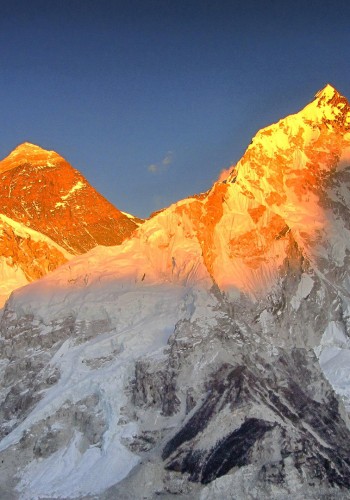
Transfer for the morning flight to Paro, the country's only airstrip. The flight often gives fantastic views of the Himalaya, including Everest, Lhotse, Makalu and Kangchenjunga. Particularly exciting is the section through the Bhutanese foothills and the thrilling landing. Try to sit on the left-hand side of the plane. On arrival you will be met by your Bhutanese Guide. It's useful to pick up a SIM card at the airport before you head off. You should have time to look around Paro this afternoon including a visit to the dzong and museum. There may even be an archery competition in the town. Overnight: Hotel Olathang Or Similar, Paro
Days: 4 - Walk to Taktsang Monastery. Visit Kyichu Lakhang.
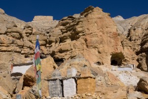
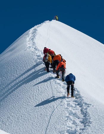
Today you will walk up to the famous 'Tiger's nest', Taktsang Monastery, perched some 2,000ft/609m up on a cliff overlooking the Paro valley and one of the iconic buildings of Bhutan. It is said to be the spot where the legendary Indian saint, Guru Padma Sambhava flew from Tibet on the back of a tiger to defeat five demons who were opposing the spread of Buddhism in Bhutan. This is a popular route so it is worth starting early to enjoy the solitude. The walk, which will provide good acclimatization, is quite steep and takes about 2-3 hours to go up - less to descend. You may choose to walk just as far as the tea house for fantastic views or climb to some prayer flags just above where the views are even better. If there is a particular religious gathering or VIP visit in progress, you will not be able to enter the Monastery but in any case it is worth climbing for a further half hour beyond the tea house to another viewpoint directly across from the monastery. If you are allowed to visit the temple itself you have to descend steeply from this viewpoint about 100m/330ft on steps, only to climb again to reach the temple where it clings to the rock face. It was built to be isolated! You then descend to your vehicle and drive to a nearby restaurant for lunch. The journey back to Paro passes Kyichu. Here you will visit the ancient temple of Kyichu Lakhang, one of the oldest in Bhutan, which was one of 108 temples built by Songsten Gampo an important early Tibetan king, to pin down the Bon demon that was thought to hover over the whole of Tibet. You may also have time for further sightseeing when you return to Paro after your trek. Overnight: Hotel Olathang Or Similar, Paro
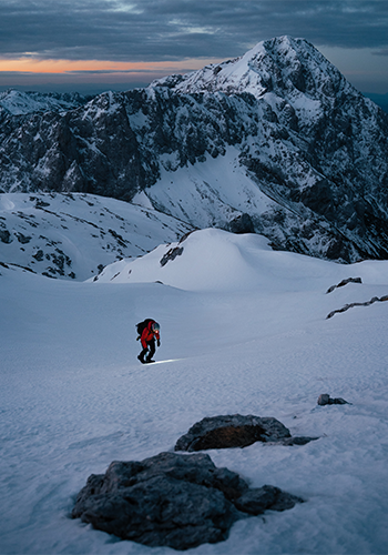
Days: 5 - Trek to Kyichu, drive to Gunitsawa, short walk to Shana, 2,788m/9,147ft – 5-6 hours.
You leave the hotel and walk up through the hills to a village. Further along is a nunnery that you can visit with some of the oldest paintings you will see in Bhutan. You continue along forested ridges until you reach Kyichu Lakhang after about three hours of gentle trekking. Your guide will be in his trekking clothes today, not his national dress, so won't be able to take you inside, but you can enjoy the surroundings again. Your bus will then take you along the increasingly bumpy road towards Shana, perhaps stopping somewhere near Drugyel Dzong for a picnic lunch by the river. From the military camp at Gunitsawa, you will walk the last hour on the old path, whilst the vehicle continues on with your gear to the camp at Shana. Overnight: Camp
Days: 6 - Trek to Soi Thangthanka, 3,586m/11,765ft - 7-8 hours.
The route follows the river in heavily forested country, with isolated farmhouses and plenty of wildlife. The Bhutanese advise you to walk in pairs as there are bears in this area. You pass a junction en route, where another path leads north over the Tremo La to Tibet. Spencer Chapman crossed the Tremo La in 1937 on his way to climb Chomolhari. This can feel a tough opening day given the altitude you are at, and especially if the undulating terrain is muddy. There are a couple of rustic stone tourist shelters and toilet blocks at the campsite as well as a basic shop and electricity if you are lucky. Overnight: Camp
Days: 7 - Trek to Jangothang, 4,102m/13,458ft - 5-6 hours.
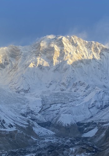
It is worth getting up early to photograph the dawn colours on Bhutan's second highest mountain, Chomolhari, which is framed at the end of the valley. After about an hour's walk, you slowly leave the forest line and gradually climb into a beautiful valley, passing Tengethang, a winter home of Yak herdsmen. There is a school here which you may be able to visit, the children enjoy it as much as you will. You should see lots of yaks today before you arrive at a large round hut, which is the base camp for Chomolhari. The 7,314m/23,997ft high mountain overlooks the camp and nearby there are the ruins of an old fortress, which used to guard Bhutan against Tibetan invasion. This is a shorter day than yesterday but you will be feeling the altitude. The camp area has another tourist shelter and basic shop. Overnight: Camp
Days: 8 - Rest and acclimatisation day.
Today you will the have chance to acclimatise and walk up to the Tsho Pho Lakes at 4,350m. On the walk to the lakes it is not unusual to see blue sheep plus birds of prey, also keep your eyes peeled for Marmot. There are some yak herders' huts by the lakes and great views back towards Chomolhari and Jitchu Drake. In the afternoon there is time to relax. At some point your mules from Shana will return home to be replaced by yaks or mules coming down from Lingshi. Overnight: Camp
Days: 9 - Trek to Lingshi, 4,001m/13,126ft, crossing the Nyele La Pass, 4,817m/15,804ft - 6-7 hours.
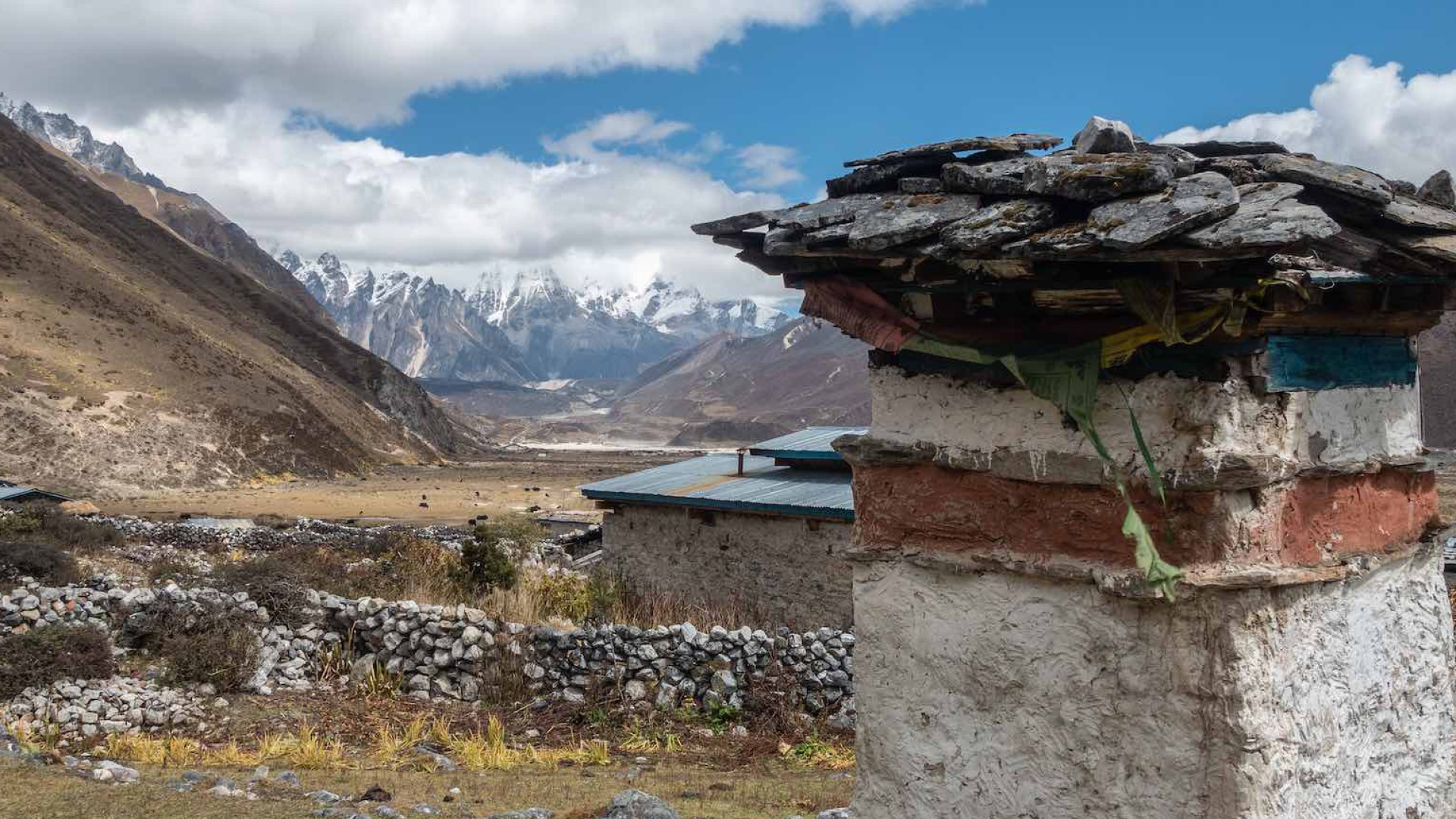
You will have a good day's walking today with spectacular views of several stunning Himalayan peaks, including Jitchu Drake, 6,850m/22,470ft, and Tsering Kang, 6,994m/22,946ft. You start climbing straight away and after some 3-4 hours reach the Nyelela Pass at an altitude of 4,817m/15,804ft. You pass yak herders' pastures and will see, if they are still in the area, their camps. Coming down to Lingshi there are the first views of a dzong atop its 600ft/183m high hill. The dzong is (just) standing despite being badly damaged by an earthquake. Camp is in the valley before and below the dzong near the huts where the workers repairing the dzong live. They are prisoners doing their time apparently, although remarkably friendly, and you should see them at work tomorrow as the path passes the dzong. They will undoubtedly wish you luck on your long trek. Overnight: Camp
Days: 10 - Trek to Chebisa, 3,870m/12,697ft - 5 hours
This is a magical day. Leaving Lingshi behind, you contour and climb gently to reach another delightful village, Gang Yul which is set right below a 300m/1,000ft cliff. Another hour's walking brings you to a lovely little valley with a huge waterfall at one end and the Shangri-la village of Chebisa, where you camp by the side of the river on the archery green in the middle of the village. Very leisurely walking today, with plenty of reasons and opportunities to linger. Chebisa is the first example you will see of a village that has benefitted from cordyceps. The houses are no longer mud huts but wonderfully large, ornate and well decorated structures. Cordyceps is a fungus that attacks and then grows on caterpillars above 3,500m in parts of the Himalaya. They are sold to the Chinese at around £10 a piece. Overnight: Camp
Days: 11 - Trek to Shomuthang, 4,222m/13,852ft, crossing the Gobu La Pass, 4,349m/14,268ft - 5-6 hours.
A walk up to the chorten en route to the waterfall before breakfast is recommended for lovely early morning views of the valley. You will have quite a stiff climb up to the Gobula at 4,349m/14,268ft, before dropping to a deserted valley full of rhododendrons and beautiful autumn colours. The path continues to traverse between valleys, eventually arriving at a couple of yak herders' huts in the valley below the Jarela. There are a couple of options for camping here depending on the time and energy levels! Overnight: Camp
Days: 12 - Trek to Robulathang, 4,152m/13,662ft, crossing the Jarela Pass, 4,635m/15,207ft - 7-8 hours.
There is now a long haul over the Jarela at 4,635m/15,207ft, where once again you get stunning all-round views and the mountain of Tsering Kang 6,994m/22,946ft. You drop steeply down a forest trail to the Tcharijathang Valley, where herds of takin are said to roam at certain times of the year. The river here is your first potential river crossing: there are usually 2 or 3 temporary logs across at a narrow point, however, if not, it is an easy crossing, well below the knee, but you might want to have your sandals with you. It is a short, steep 40 minute climb out of the valley onto a flat shelf where you camp in the most wonderful amphitheatre of mountains. The valley below is full of yak herders' huts and their animals. Overnight: Camp
Days: 13 - Trek to Limithang, 4,118m/13,510ft, crossing the Shingela La, 4,912m/16,115ft - 6-7 hours.
This is one of the hardest, but most rewarding, days of the trek. You climb slowly up to the Shingela, which takes some 5 hours, to be rewarded with stunning views of mountains, including the spectacular Gangchentak 6,794m/22,290ft at the head of the valley. On a clear day, almost all the mountains on the northern border are clearly visible, 10-20 miles distant. Eagles, Griffin Vultures, Blue Sheep and yak abound in this area and on your descent you may once again see nomadic yak-herders. On the way down you will pass a glacial lake that recently burst through the moraine that contained it; the remains of the flood damage are still evident. You camp in a lovely spot by the river bank. Overnight: Camp
Days: 14 - Trek to Laya, 3,812m/12,506ft - 4 hours.
You will have a relatively leisurely walk today alongside the river to reach the largest village on the trek, though the walk does entail quite a bit of ascent and decent and quite a stiff climb at the end. Laya is a large and prosperous town spread across the hillside. It has a large school, electricity, a phone signal and is now only a day from the roadhead at Koina. Unlike the village in Nepal though, there are no tourists, tea houses, cafes and only a couple of basic shops. The people of Laya are famous for their vertically striped yak-hair clothing and strange conical bamboo hats. The women wear their hair long and have a great deal of turquoise and jade jewellery. The features of the people are even more Tibetan/Mongolian than the Bhutanese who live in the central valleys. The rest of the day is spent at leisure or visiting the village. Good views of Masagang, 7,165m/23,507ft, and other peaks. Overnight: Camp
Days: 15 - Rest day in Laya.
During your rest day there will be an opportunity to meet local people. Hot stone baths are also on offer, something not to be missed, and it is worth walking up to the top of the town for the views from the park benches up there. New pack animals will join you here. It is more common now to take mules from here through to the end of the trek from where they get back to Laya by road in horseboxes. This avoids the horsemen having to return back over the high passes as the winter snows come in. Overnight: Camp
Days: 16 - Trek via Taksaka to Rodhophu, 4,206m/13,800ft - 7-8 hours.
A tough day made longer with the packing of a new set of mules and yaks. You descend from the village a long way down into the start of the gorge. Look out for the ancient wooden gateway leaving the village. It is an hour and a half to reach the small army post of Taksaka. After a further forty minutes down the gorge you turn left, 3,240m/10,630ft, and start to head east towards Lunana. This is the start of your journey to Lunana proper. Turning east you gradually climb through forest to a clearing with the remains of an old hut. There may be nomads camped near here. In places the path is high above the valley floor and the herders have to take care with the mules. You proceed in and out of the tree line, all the time climbing gradually into a high altitude valley with an impressive river and rapids. Eventually, you enter a flat-bottomed valley ringed with rocky mountains and a ruined tourist shelter. This is camp! With the ups and downs, it is 1,000m of ascent from the checkpost: this is a long hard day and if the weather is inclement can be quite a challenge. Overnight: Camp
Days: 17 - Cross Tsome La Pass, 4,709m/15,450ft, and trek to below Gangla Karchung La, 4,900m/16,076ft - 5-6 hours.
The path up here can look quite exciting, however it is far better than it looks and in 2019 a gang of workers were camped here, substantially improving the route. 2-3 hours walking brings you to a small pass called the Tsome La, 4,709m/15,450ft. You are now in a region that is totally remote and exceedingly beautiful and as the day wears on the views and remoteness become even more acute. After the pass the route crosses an undulating series of ridges and then contours around a large mountainside; you may see a yak herders camp below. On and on, closer and closer to Gangla Karchung, until it rises sheer in front of you. This is one of the few mountains in Bhutan that has been climbed - in this case by a French expedition. The campsite below the face is spectacular. Overnight: Camp
Days: 18 - Cross the Gangla Karchung La, 5,156m/16,916ft, to Tarina, 3,919m/12,857ft - 6-7 hours.
A great day! The climb up to the pass is rewarded by wonderful views of the glacial lakes and Kang Bum, 7,100m/23,294ft, hemmed in by moraine dams at the head of the first of the Lunana valleys. These lakes are the source of the Po Chu and are like snakes twisting down the valley. The path then runs down through a wide belt of rhododendron with stunning views in all directions. It is a long descent, previously described as steep and slippery, though since 2019 is is a vastly improved path. A choice of various camp sites are available amongst stunted heather. Overnight: Camp
Days: 19 - Trek to camp above Woche, 4,114m/13,599ft - 6 hours.
A pleasant walk down the valley past a clearing named Tarina. The valley is hemmed in by rock walls and rocky peaks on all sides. Every half mile, spectacular waterfalls come thundering into the valley with its pine clad hillsides. The valley itself is a mass of colourful heather, flowers, brushwood, with no sign of human habitation. Finally, there is a steep climb through the forest at the end of the valley and contouring round to the first Lunana village of Woche. Woche used to be a simple village where you might get a butter tea. It is now another 'cordyceps' village with large, beautifully painted timber houses that would be more at home in the Swiss Alps. You might enjoy lunch here and get to meet some of the locals tending the fields and their animals. Most of the children will at the Lunana School which you will pass tomorrow. The crew will probably want to push on to the foot of tomorrow's pass, another hour and a half. It is a beautiful, flat, grassy campsite on the far side of the river with plenty of grazing for the mules. Overnight: Camp
Days: 20 - Trek to Lhedi, 3,728m/12,231ft, across the Kashe La Pass, 4,556m/14,947ft - 6-7 hours.
From the the camp site near the river there is a steep haul to cross the Kashe La, 4,556m/14,947ft. On the way you pass a sacred lake, a beautiful pea green colour. You shouldn't throw stones into this as it would anger the spirit of the lake. Continuing, there is a huge cairn of stones and prayer flags on the pass before walking down the other side quite steeply, to the little village of Tegar. Watch out for the very pretty chorten just before the village. A new path traverses left above the village slowly losing height towards the valley floor. There is a particularly exciting cantilever bridge over a roaring torrent coming down between two cliffs. This is now the main valley leading up to Thanza in the distance - the wind rattles through it and the vast flood plain is evidence of the 1994 moraine breach. Lhedi is a string of houses on a terrace high above the river, rock walls behind and terraced fields in front. There is space to camp just after the village on the archery course. The school is definitely worth a visit. Children come from the surrounding villages and board here. In mid-November the teachers are helicoptered out and the school shuts for winter. Overnight: Camp
Days: 21 - Trek to Thanza, 4,126m/13,537ft - 4-5 hours.
Route descriptions vary massively on this section, mostly because of the chaos and route changes caused by the moraine dam burst. It is only really a four hour walk, though it is worth enjoying and stopping in Chozo. Firstly, you follow the river for several hours to a junction of valleys, the main river flowing out of a much higher plateau down through numerous rapids. Once into the upper valley it broadens right out flat, with the river forming lakes and broad reaches and shortly afterwards you arrive at the village of Chozo. This is the only village that has a dzong in Lunana, which is well worth a detour to take a peek at. The people of Lunana are very superstitious and have very strong beliefs in the spirits of seven Tibetan brothers who many hundreds of years previously were defeated in a battle in Tibet. Each of these spirits dwells in their own locality in Lunana. The most powerful, Chumna, lives in a wood near the dzong of Chozo. Carrying on across the plain, assisted by the wind, (look out for the large area of rippled sand) you eventually reach another rise into an even higher upper valley. Here there is a big village split either side of the river. To the north are the rock-walls behind which is the 7,300m/24,000ft Table Mountain and to the south are more snowy mountains. Again the village people are friendly, although they see very few westerners. Thanza is the largest village in Lunana and there is always plenty of activity to watch. Most houses have solar panels, and there is a phone signal: the last now till you reach the roadhead. Overnight: Camp
Days: 22 - Rest day in Thanza.
The rest day today will be well-earned and extremely welcome. You may wish to do a few personal chores before spending time wandering around the village, meeting people and discovering something of the hard way of life of these remote tribespeople. The next 3 days are the longest of the trek, and there is increasingly a trend to set off in the afternoon of the rest day to get 3 or 4 hours up the valley. Most groups prefer to have a full rest day followed by 3 long days, but your leader may want to make the decision based on the weather forecast and group fitness. Overnight: Camp
Days: 23 - Trek to before Gophu La, stop at Tshorim, 5,225m/17,142ft - 7-8 hours.
You will climb steadily for an hour to a cairn, undoubtedly sad to be leaving Thanza, but full of excitement about crossing the Gophu La. Looking back down the valley, Chozo and its dzong can be picked out and as it is an early start, smoke will still be drifting off the roofs of all the houses in the villages below. You carry on now, up a valley, more rapids and minor waterfalls, towards a large, pointed rock peak at its head. Slowly, but surely you come opposite the granite mountain, to have lunch in a circular low stone wall shelter. Carrying on, the scenery becomes more magnificent, until you reach camp near a lake surrounded by snowy peaks. The last few hours can be tough, winding their way through moraines with no obvious end in sight. There are two campsite options depending on how you are progressing: the first before and the second below the lake. It will be very cold at night whichever you stop at, though stunning. Overnight: Camp
Days: 24 - Cross the Gophu La, 5,454m/17,894ft, to Geche Woma, 4,625m/15,174ft - 8 hours.
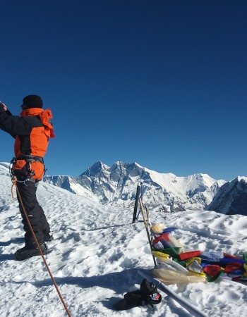
This surely must be one of the most beautiful trek days anywhere in the Himalaya. Try to see the sunrise, as the pink colours on the high snows are really fabulous. It is, in fact, not far to climb to the main pass, skirting around the edges of lakes, which, on a still day, mirror the ice-fluted peaks that you are passing between. As you come to the Gophu La, the highest mountain in Bhutan, Gangkar Punsum, 7,550m/24,770ft, towers above the horizon. It seems to be a piece of earth elevated to a higher, purer plain and is completely dazzling. It is a very long and tiring descent through moraines and boulders to the valley floor which is still at 4,800m. There is a river crossing here with no bridge so you may get wet sandals. There are usually boulders to get across on but some may be below the surface of the water and slippery. The crew will help you here, but you will be tired so take your time. Geche Woma is the name of the camping place in the valley but actually ther are three different places you can camp spread out down the valley. Ideally you want to get to at least the middle site otherwise tomorrow becomes a very long day. Coming down into the valley look back and see a 'Rupert Bear' peak framed at the end - perfectly conical and if you are lucky, ringed with cloud. Enjoy the remoteness, this is a very wild setting. Overnight: Camp
Days: 25 - Cross the Saga La pass, 4,930m/16,175ft. Trek to Sachu Kheti, 4,267m/14,000ft - 7-8 hours.
The path follows on down the valley now, completely uninhabited, before a track leads back up the hillside to a small plateau. From there it climbs for 45 minutes to the lunch spot. After a welcome rest you cross a small pass and wind down to some yak herder huts. You then cross a narrow defile, past a large slope of sand, perhaps part of the old Tethyan Ocean. Coming to the top of the slope you are faced with an amazingly beautiful lake, locked in by a circle of rocky peaks, with an impossible looking path contouring up and around to a col, the Saga La Pass. The views are wonderful from this very dramatic point. From here you drop down steeply but on an easy path to your campsite with cliffs and rocky peaks all around. You will have now passed the turning for Dur Hot Springs and the Bumthang exit, and will be breaking out into genuinely unexplored territory. This is a long day and could be split at the yak herder's hut if needs be. Overnight: Camp
Days: 26 - Cross unnamed pass, 4,520m/14,829ft, trek to Demsho Wom, 4,520m/14,892ft - 4 hours.
A fabulous day as you strike out for a week into the mainly uninhabited stretch of mountains between you and the road head. There are many blue sheep in this area. From camp it is steeply, but easily, down for an hour to a bridge. Stop and enjoy watching the yaks cross over. It is now a lovely afternoon climbing slowly up to a small 'pass' above the camp at Demsho Wom. The climb takes about 3 hours stopping for lunch en route or having it in camp on arrival. As you get higher there is a great vertical cliff on your right. To your left is a stream cascading over the lip of a valley above and crashing down steep rapids. Looking back you can see the other side you have just descended, and the horizon is a line of snow peaks and cliffs. The granite ridges produce odd shaped towers, unusual spires, mushrooms of rock and great cantilevered flakes. There are the sounds of Himalayan pheasants and choughs, and rhododendron everywhere. You also get views of the Saga La Pass. The path contours improbably and rises to a small pass. Camp lies just below, next to the stream. A huge valley meanders off to your right with more intriguing peaks and cliffs. Spend the afternoon relaxing or exploring the surrounding valleys. There are several high viewpoints easily achievable. Overnight: Camp
Days: 27 - Cross Demsho La pass, 4,848m/15,905ft, and continue trek to Tshering Dorji Yak Herder Camp (Meluthang), 4,425m/14,518ft - 6 hours.
What a day! Another big challenge. 45 mins from camp you come to a large lake, Demsho Lake, and above that two smaller lakes. Now you turn right for the pass which may be snow covered. In 2016 our group saw the tracks of fox and snow leopard and just near the pass they saw a small rodent-like creature with ears like small saucers. They also saw three deer sprinting across the snow. Below the pass is a huge, beautiful valley containing two big lakes, one behind the other. You are so far from civilisation now. The air is clean and clear and nature is completely unspoilt. A magical place. From the end of the second lake you come to a 'lip' in the valley which falls away below you. The stream is like a snake heading off into the distance. Further down you come to some hillocks on your left and behind one of these is a yak herder's summer hut belonging to Tshering Dorji and his wife Pem Dem. They live here for 7 months of the year. Pem's brother Namgay lives over the other side of the hill to the east. Camp below their hut. The river needs crossing to get to camp, but there are a couple of places where the boulders are so large they are like bridges. Overnight: Camp
Days: 28 - Rest and exploration day.
You'll probably want to relax today, but if not then the ridges on either side of camp are easily achievable and offer great views. Overnight: Camp
Days: 29 - Cross small pass, 4,360m/14,340ft, trek to Padim, 4,515m/14,813ft - 5 hours
A grand day! You leave the lovely camp at Meluthang behind with its yak hut on the hill and its resident ravens, and it is steeply downhill for less than an hour to a bridge. In 2019 we met a family camped here with their 70 yaks as they slowly made their way out to Sephu for the winter. We enjoyed butter tea and yak cheese with them. After this it is a steep zig zag climb of 250m for an hour to then follow a traverse around a bowl in the mountains which climbs to a 'pass' and a small cairn. There is then a slanting descent to above a most beautiful lake. It is hemmed in by mountains and granite cliffs and is a lovely colour of green. The path goes around the lake, but several hundred feet above it, eventually climbing up and out of this bowl with big drops below, to a level grassy platform. This platform gives the most wonderful views of the massive main valley stretching several days hard walking in either direction. Hugely impressive! The mountains you have passed through are stacked on the horizon. Leading off the main valley are many side valleys, and right opposite is the valley where Tshering Dorji, Pem Dem, their son Wangchuk and their herd of yaks live. Beyond their valley is the one Namgay lives in, and beyond that again are various other valleys that the herders from the Tongsa region inhabit in the summer. It is said that there is a path that leads to Gangkar Punsum heading north, but for humans only; it is too difficult for animals. That must be something!! After soaking up the view the path traverses around the mountainside to a small bowl with room to camp. If the weather is kind the sunset and sunrise from this eyrie are sensational. Overnight: Camp
Days: 30 - Trek across the Khemi La, 4,572m/15,000ft, to below the Chachi La, 4,361m/14,308ft - 6-7 hours.
Worth getting up early for the fiery orange sunrise over the peaks to the east and north. A steep short path leads to a small unmarked pass, and then there is a very fine path to the left of the mountain leading to the Khemi La marked by a cairn and prayer flags. One hour to the pass. Fantastic views on both sides of un-named, un-climbed mountains on both sides of the pass in an un-known area. Our guide and our cook had been this way previously with friends and came upon a herd of thirty Takin here. It is now three hours to the river far below, 3,560m/11,680ft. As you get nearer the river there is a massive rock wall on your right. The bridge and the ferocious rapids stun and amaze, and lunch will probably be taken near here. Then it is a long ascent through giant moss encrusted rhododendron with a thundering stream to the left. A 565m climb brings you to a huge lake penned in by mountains, where the stream needs to be crossed on easy stepping stones. The sting in the tail is another forty minutes to a great camp above the lake. This is a popular yak herders' pasture and there are many stone shelters and enclosures here, though the herders will probably have already left after the summer months. Overnight: Camp
Days: 31 - Trek to Maurothang, 3,682m/12,080ft, across the Chachi la pass, 4,638m/15,216ft - 6-7 hours.
Above camp is another lake which is traversed on the east to enter a small cwm. Half an hour to the lake, half an hour to the top of the cwm. Now the climb to the pass begins in earnest. The pass could well be snow covered. Again to reach the Chachi La Pass is about an hour from the head of the cwm turning right up what seems the least probable of routes out of the valley. Great exultation on reaching the pass, the last big crossing! Many a group photo is needed here, and for those with energy, the grassy slopes up to the right provide even better views looking back down. If there is snow on the pass then again you may well see evidence of wild animals. Wonderful, wonderful views and on a clear day you can see Gangkar Punsum and many, many of the biggest peaks on the border with Tibet. There is a great colossus of a black rock peak looming over the pass too. Now begins the big descent. An hour brings you above a lake fed by a stream in the shape of a serpent - with beautiful views and prayer flags it makes for a fine lunch spot. Civilisation approaches! First a summer village of 13 huts, and at the bottom of the valley another 7 huts. Then you reach a junction with the main path coming from Lunana. This is the route many parties use. Five and a half hours from last night's camp to this point. Fifteen minutes more and you reach the first shop, and another fifteen minutes to the first of a couple of campsite options at Maurothang. Overnight: Camp
Days: 32 - Trek to Sephu, 2,672m/8,766ft - 5-6 hours. Drive to Punakha - 3½ hours.
The last day's trekking! It is a long walk down the valley, mainly through forest. The path is pretty 'bouldery' and focus is needed. After the first hour you cross the main river to the left bank. Another forty five minutes brings you to a rather odd pagoda. Several more bridges and forested paths lie ahead with ever increasing signs of human habitation. Finally, without warning, you come to the end of the trek at a tarmac road at the Wangchuck Centennial National Park sign and transport awaits. All aboard the magic bus to hot baths, warm comfortable beds and beer in Punakha. Overnight: Zhingkham Resort Or Similar, Punakha
Days: 33 - Sightseeing in Punakha. Drive to Paro - 4 hours.
You will have time in the morning to do a little sightseeing in Punakha. A visit to the dzong is a dazzling experience. It is one of the largest and oldest monastery fortresses in Bhutan and the history and legends surrounding it are fascinating. In the afternoon you will drive over the Dochu La pass, and bypassing Thimphu, you will carry on to the Paro valley. Overnight: Hotel Olathang Or Similar, Paro
Days: 34: Fly Back to Kathmandu
After breakfast, transfer to Paro International Airport for flight back to Kathmandu. Kathmandu arrival and transfer to hotel and rest. Accomodation: Overnight at Hotel in Kathmandu. Meals: B
Days: 35: Departure transfer to Kathmandu airport
The airport representative from Nepal New Generation Family will transport you to Kathmandu International Airport around 3 hours before your scheduled flight from where you will depart. Meals: Breakfast included.


 Available